This page contains affiliate links. Please read our disclosure for more info.
Wellington is a city for walkers. Not only is the compact centre of New Zealand’s capital very walkable—especially the beautiful waterfront—but the city is surrounded by nature with hills, bush, and rugged coastline easily accessible.
These are our favourite walks in Wellington after spending many months in the region.
They can all be completed in half a day or less with options for all abilities—from a flat seaside stroll to see seals at Red Rocks to the more challenging Skyline Walkway for epic views.
You’ll find a map of all these Wellington day walks at the end of the post.
Contents
- Best Walks in Wellington
- Further Afield Walks in Wellington Region
- Wellington Walks Map
- Useful Resources
- More North Island New Zealand Posts
Best Walks in Wellington
These scenic Welly walks are close to the centre of Wellington. Some can be walked from the CBD (Central Business District), while others are a 10 to 30 minute drive away.
Note that the times given for each walk are based on how long they took us and don’t include breaks.
In addition to these hikes in Wellington, see our guide to the best things to do in Wellington for easy walks in the Botanic Gardens, Zealandia, Mt Victoria, and along the waterfront.
1) Southern Walkway
Distance: 10.7km one way
Time: 3 hours
Total elevation gain: 355 metres
Facilities: No toilets or shops on the trail, but you could detour into the suburbs.
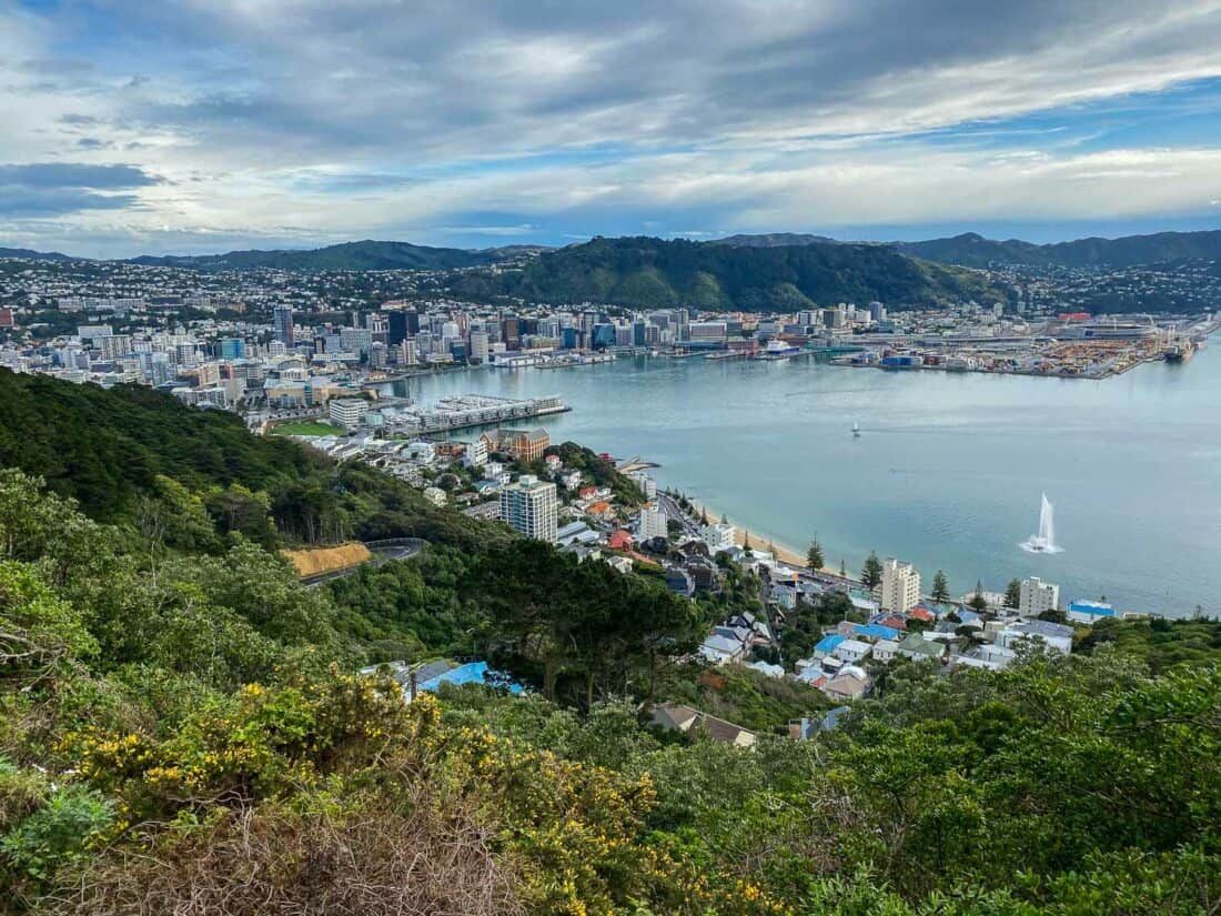
The Southern Walkway is an excellent Wellington walk for visitors staying in the CBD as it takes you from Oriental Bay (the beach near the centre) to Island Bay on the south coast.
It’s a great overview of the city on a varied trail along the Town Belt through forest, parks, suburbs, and finally along the rugged coast.
It starts with a climb up to the Mount Victoria Lookout for the best views of the city and harbour.
There are some uphills and muddy sections, but we didn’t find the hike too challenging. The trail is marked with pink signs and is easy to follow.
The Southern Walkway is very flexible as there are multiple entry points. We started at a friends’ house near Mt Victoria and when we reached the coast at Houghton Bay we went left to Lyall Bay rather than right to Island Bay.
The final section in either direction is on a path next to a road, but it’s very scenic.
I recommend finishing in Lyall Bay if you want to get lunch after the hike as it has better food options (The Botanist is ideal for vegans). This route was 11.7km and took us three hours.
How to Get to the Southern Walkway
Look for “Start of Southern Walkway” on Google Maps. There are signs for the start near the intersection of Oriental Parade and Carlton Gore Road in Oriental Bay.
If you are walking from Te Papa in the centre of Wellington, allow an extra 1.8km/20 minutes to get to the trailhead, or you could take a bus.
The official trail ends at Shorland Park in Island Bay. From here (or Lyall Bay) you can take a bus or Uber back to the centre (it’s a 15-minute drive).
2) Eastern Walkway Loop
Distance: 5.7km loop
Time: 1 hour 40 minutes
Total elevation gain: 208 metres
Facilities: No toilets or shops. The nearest facilities are in Lyall Bay.
If you are looking for a shorter hike in Wellington, the Eastern Walkway on the Miramar Peninsula is one of my favourites, and it’s never very busy.
The trail starts at Tarakena Bay where you walk up a small hill to the Ataturk Memorial. From there it’s a mix of walking through native bush (with lots of birds) and open sections with views of the stunning coastline.
You can see ferries returning to Wellington, the Pencarrow Lighthouse, and even the snowy mountains of the South Island on a clear day.
The undulating trail is not too difficult but expect quite a few steps.
Follow the signs to the Pass of Branda and then walk down the road to Breaker Bay. It’s worth a detour to this beautiful beach backed by cliffs with a rock archway.
Otherwise, head right for an easy 30-minute walk on the path next to the quiet road back to where you started. We enjoy admiring the houses on this lovely stretch of coast.
I like to combine the Eastern Walkway with breakfast in Lyall Bay or lunch and a swim in Scorching Bay. See my Wellington activities guide for more tips on the area.
How to Get to the Eastern Walkway
Look for “Eastern Walkway trailhead” (listed as in Breaker Bay) on Google Maps. It’s on Moa Point Rd in Tarakena Bay around the headland from the airport and Lyall Bay. It’s a 15-minute drive from the centre.
If the small car park at the trailhead is full, there’s a larger one a minute back towards Lyall Bay.
There’s no phone signal at the trailhead, but there is once you climb the hill.
There are signs for the start of the trail and then it’s easy to follow.
You could also walk the Eastern Walkway in the other direction starting at Breaker Bay Car Park (near the beach).
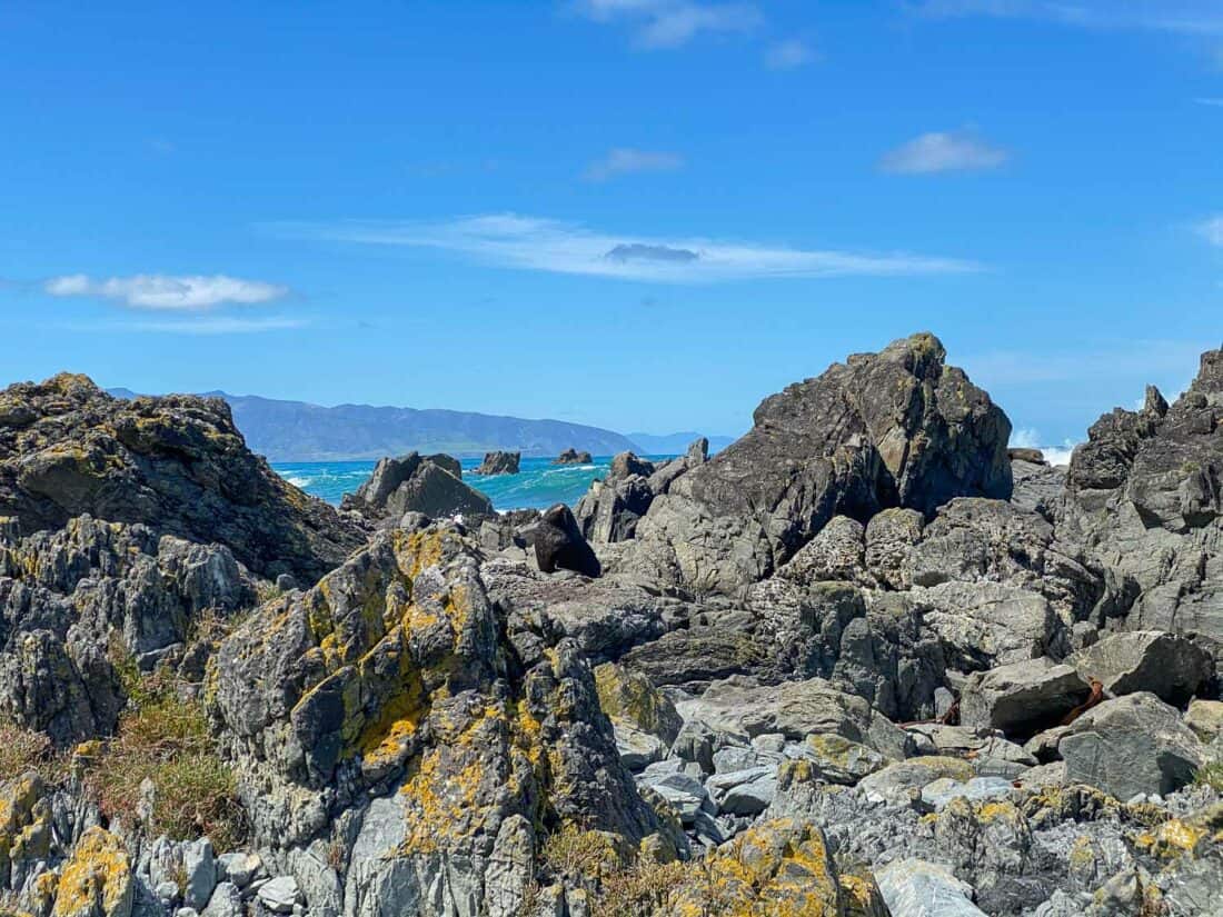
3) Red Rocks Coastal Walk
Distance: 7.6km return
Time: 1 hour 50 minutes
Total elevation gain: 38 metres
Facilities: Toilets at the visitor centre (and sometimes a coffee cart).
For a flat, easy walk in Wellington with stunning coastal views and seals, head to Red Rocks on the scenic south coast.
You walk on a gravel 4WD track along the rugged coastline where green hills meet the grey sand beach and cobalt sea. On a clear day you can even see the South Island.
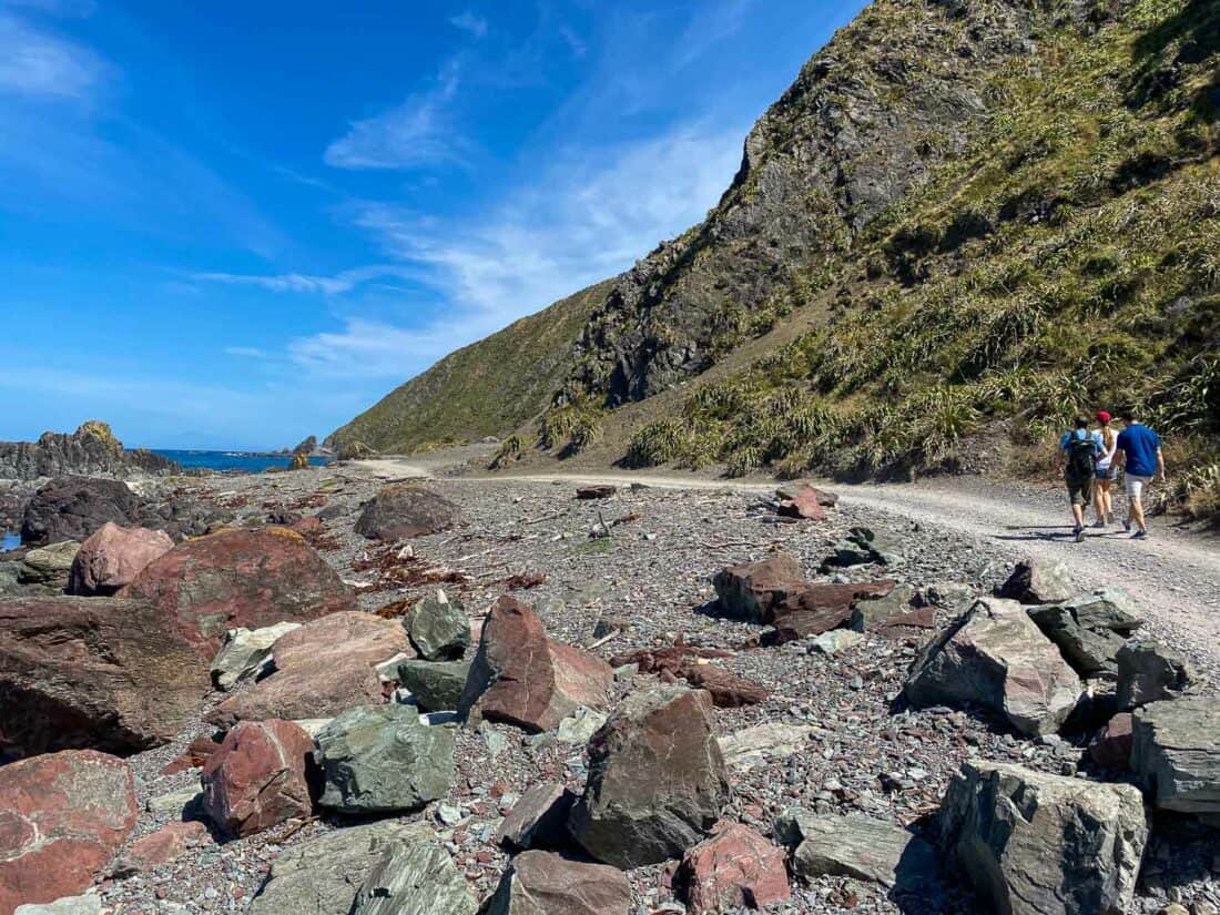
Eventually, you’ll reach the actual red rocks (coloured by iron in the rock). Keep going to Devil’s Gate (a small hill with an opening in the rocks) and beyond that is Sinclair Head, where you can see fur seals lounging on the rocks.
Winter (May to October) is the best time to see the seals, but we saw a few in summer. Make sure you keep your distance from them.
This is an out and back hike, so after admiring the seals, turn and walk back to the visitor centre.
Red Rocks is an exposed area that can be very windy, so it’s best on a calm day or take layers.
I do not recommend trying to drive the 4WD track—we’ve seen multiple cars get stuck. On Sundays the track is only open for pedestrians.
How to Get to Red Rocks
Look for “Te Kopahou Visitor Centre” in Google Maps. This is in Ōwhiro Bay, a 15-minute drive from the centre. There’s a large car park (with freedom camping allowed) and the start of the trail/4WD track is obvious from there.
4) Skyline Walkway
Distance: 13km one way
Time: 3-5 hours
Total elevation gain: 600 metres
Facilities: No toilets or shops. Pack plenty of food and water.
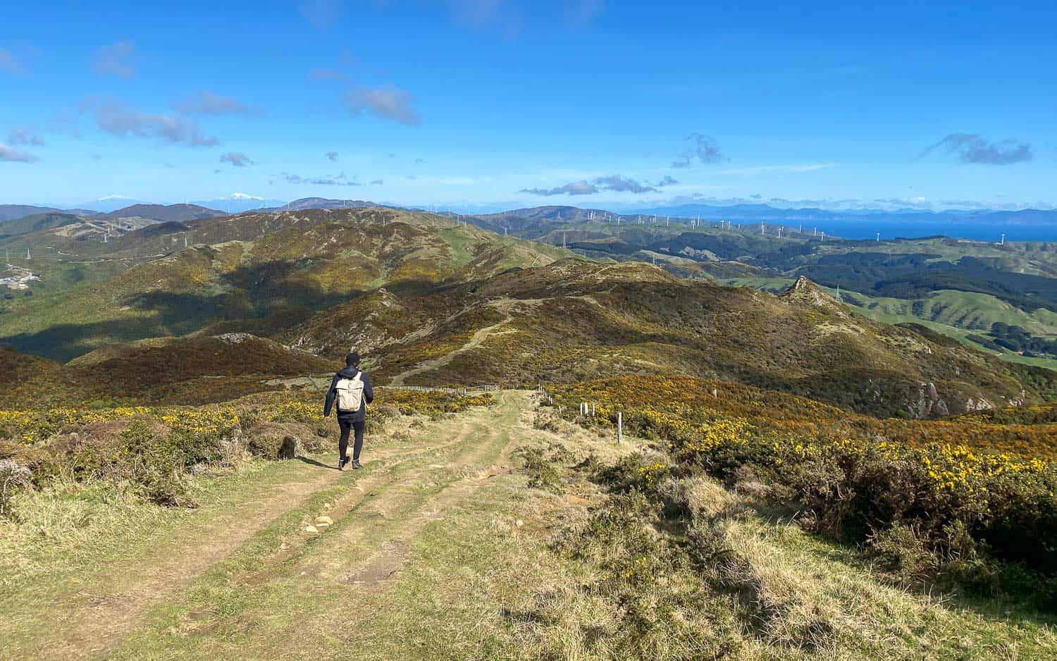
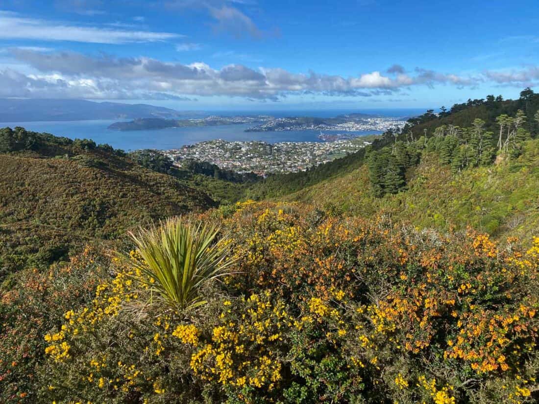
If you are up for a more challenging Wellington hike, the Skyline Walkway is the most spectacular trail in Wellington.
It’s not far from the centre, but you feel like you’re in the countryside, and we only saw a few other hikers on a winter weekday.
The trail runs along a ridge from Johnsonville to Karori. It’s exposed and can be windy, but the views are stunning throughout. You can see down to the city and across rolling green hills to the sea on each side.
In winter the hillsides are covered in yellow gorse flowers and you can see the South Island’s snow-capped mountains.
There are various access points so you don’t have to walk the whole thing.
We made the hike a little shorter by starting at the Northern Walkway trailhead in Johnsonville and coming down at Otari Wilton’s Bush, finishing with a lovely forest walk past an 800-year-old rimu tree. This 11km hike took us 3.5 hours plus breaks.
The hardest section in this direction is at the beginning as you climb to the highest point at Mt Kaukau for spectacular 360º views. After that the trail is undulating.
How to Get to the Skyline
The Skyline is best done as a one-way hike (in either direction). We had two cars, but there are buses near each end or you could get an Uber.
To start from the Johnsonville end (as we did), look for “Skyline Walkway trailhead – Old Coach Road” on Google Maps. It’s a 20-minute drive from the centre.
You’ll end at “Skyline Walkway Trailhead – Makara Saddle”, which is also 20 minutes from the centre.
The Skyline is easy to follow with purple markers.
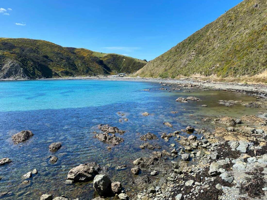
5) Makara Beach Walkway
Distance: 6.7km loop
Time: 2 hours
Total elevation gain: 215 metres
Facilities: Toilets at the start at Makara Beach. There’s also a cafe open on weekends.
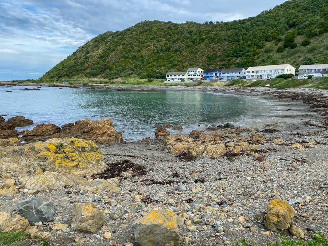
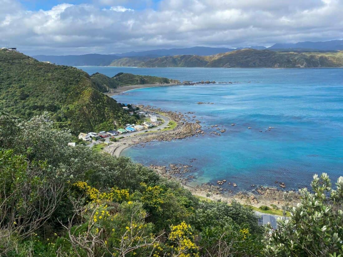
Another stunning Wellington walk is the Makara Beach Walkway. This is further from the centre than the others, but you pass pretty countryside on the way and it feels very remote.
Makara Beach is a pebble beach on a rocky shoreline backed by green hills. There’s not much here except for a few baches.
You can choose from a few different trails—we did the loop track, which starts along the coast and then climbs a steep grassy hill.
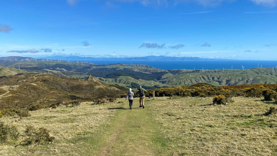
The views back down to the bay are gorgeous—lush hills, turquoise sea, windmills on the hillside, and over to the South Island, which feels so close.
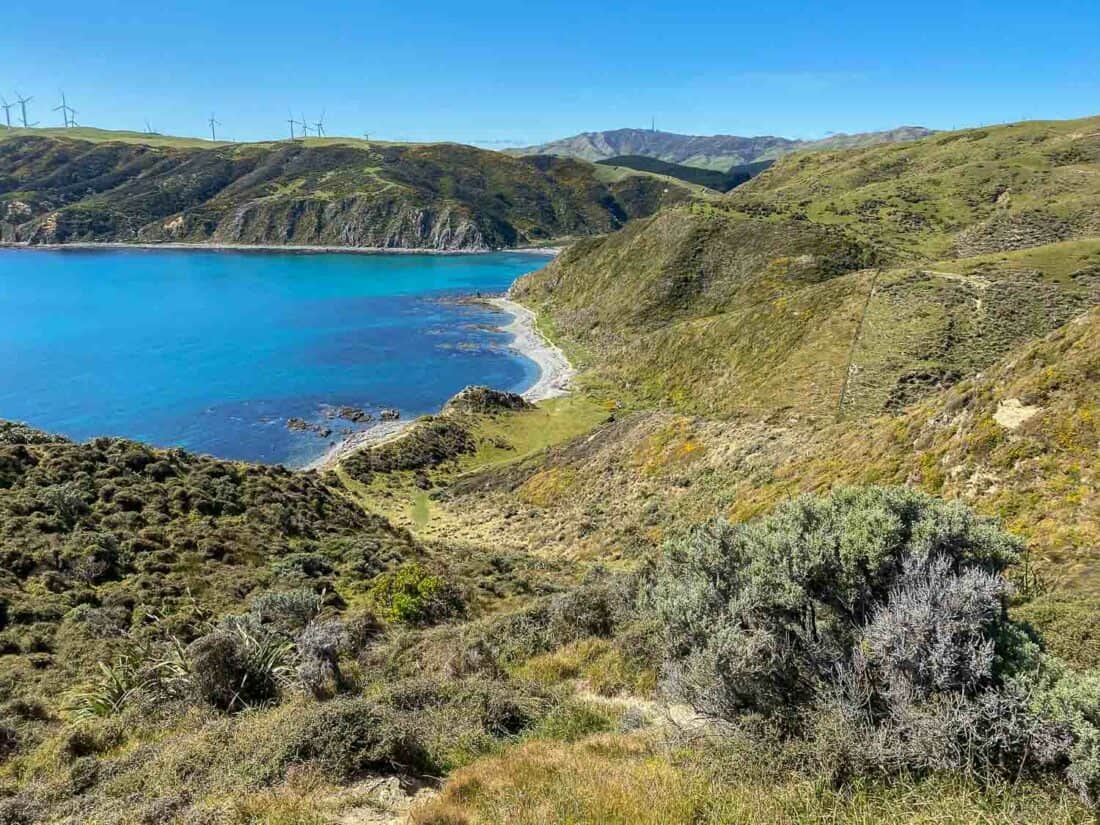
At the top there are WW2 gun emplacements and you can also detour to the wind turbine farm (we didn’t).
We then followed the 4WD road down to Opau Bay. This section is closed during lambing season in August and September, but you could return the way you came.
Once at the bay, the walk back to the starting point is flat, but it’s quite tiring walking on the pebble beach with some rocky scrambles. We stopped for a packed lunch on the beach and you could also swim.
The whole trail is exposed so pack a hat and suncream. It’s best on a calm day—avoid it when the northerly winds are blowing.
How to Get to Makara Beach
The hike starts and ends at Makara Beach at the end of Makara Rd, a 30-minute drive from the Wellington CBD. There’s plenty of parking.
Walk left along the beach to find the start of the trail.
Further Afield Walks in Wellington Region
These walks are further from Wellington, around 40 to 60 minutes away, but they are well worth the trip out.
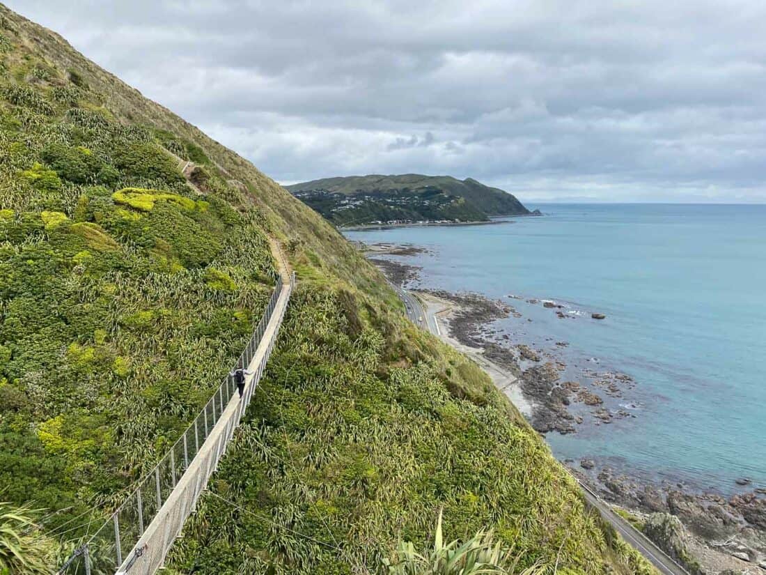
6) Paekākāriki Escarpment Track
Distance: 10km one way
Time: 3 hours
Total elevation gain: 517 metres
Facilities: No toilets on the trail. There are public toilets, cafes, and a shop in Paekākāriki at the start.
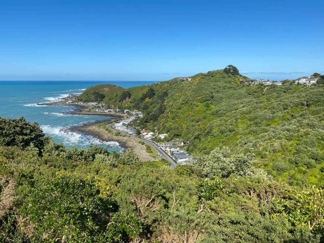
The Escarpment Track is part of the Te Araroa Trail, which runs the length of New Zealand. It’s one of the most beautiful hikes in Wellington with gorgeous coastal scenery.
This Kapiti Coast trail is usually hiked one way from Paekākāriki to Pukerua Bay (or vice versa).
Heading south from Paekākāriki, the first 3km/45 minutes are fairly flat and easy as you walk through the bush. You then begin to ascend some of the trail’s 1200 steep steps.
The steps can seem endless, but there are benches for breaks and the views get better and better. You can see across green hills to the expansive Tasman Sea and over to Kapiti Island.
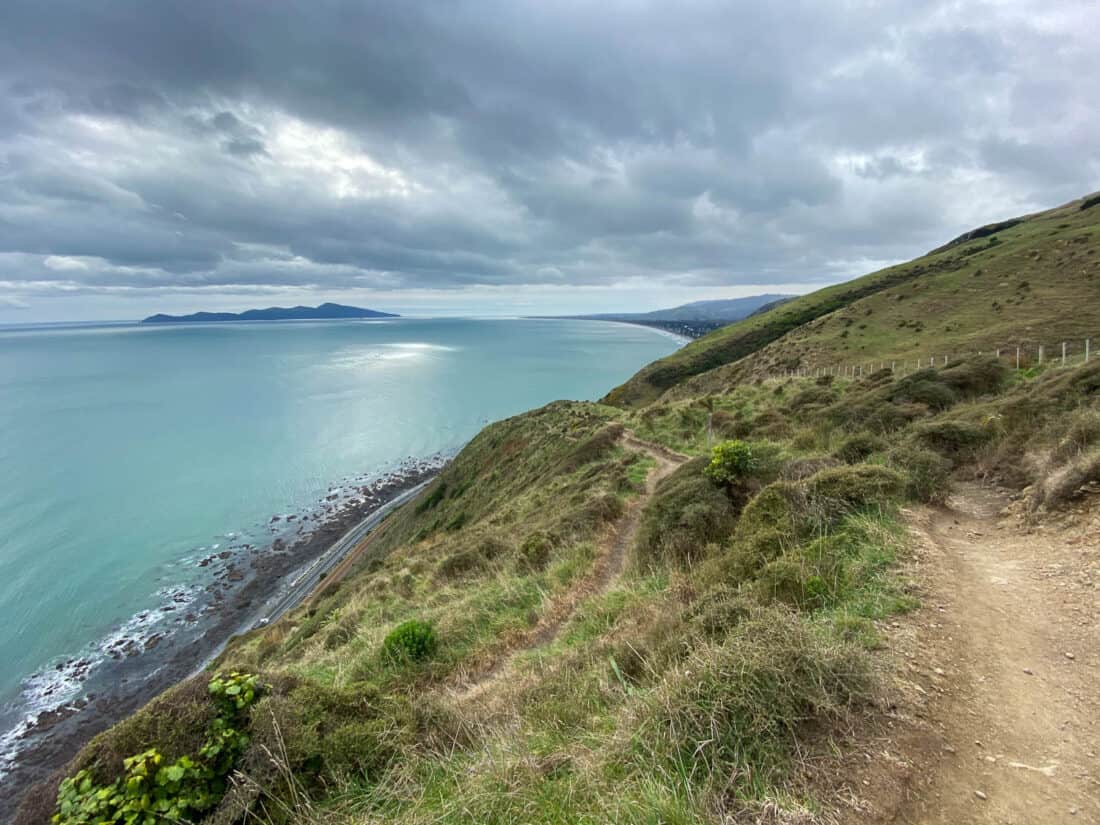
In winter the hillside is covered in yellow gorse flowers and in October, it’s a riot of pink.
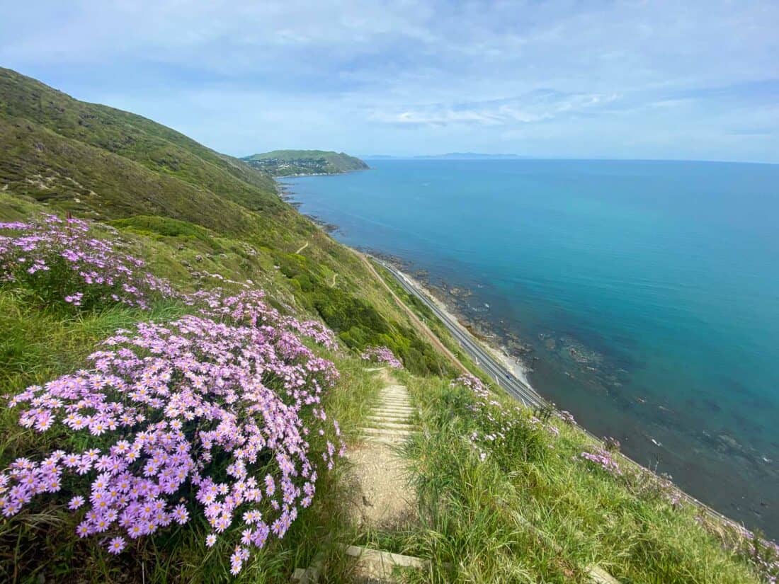
It usually takes us about 25 minutes up the steps to the highest point 220 metres above sea level. There are several benches here and spectacular views, so it’s the perfect place for a snack break.
After that the undulating trail feels much easier, although it is narrow and there are some steep drops, so it’s not ideal if you are scared of heights.
There are more uphill steps later in the walk, but no sections as long as the first. Towards the end you’ll cross two swing bridges.
As the trail is narrow and mostly exposed, I recommend starting early, especially on weekends, before it gets too busy and hot. Pack a hat and plenty of water.
How to Get to the Escarpment Track
Paekākāriki is a 40-minute drive from Wellington. You can also get there by train, which is a great option as you can walk the track and then return to Wellington from Pukerua Bay station.
The track starts at Paekākāriki train station—follow the signs which will take you on a bush trail next to the highway.
You’ll cross under the bridge before starting the main section of the trail. Once you are on the track you can’t get lost.
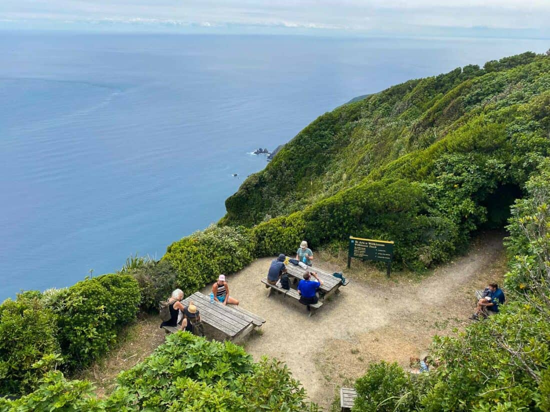
7) Kapiti Island Summit Walk
Distance: 7.5km loop
Time: 2 hours 40 minutes
Total elevation gain: 508 metres
Facilities: Toilets at the start and just before the summit.
Kapiti Island is special and I highly recommend hiking here, even though it’s the only walk on this list with a price tag ($80).
The island is a protected nature reserve and you can only visit with one of two companies who will arrange your permits and boat transport. We went with Kapiti Island Eco.
For the best hiking, make sure you book a trip to the Rangatira landing in the middle of the island. From here you can walk to the highest point on the island.
Kapiti Island is predator-free so native birds thrive. As soon as we stepped onto the island we heard the immense chorus of birdsong, unlike anything on the mainland.
You’ll get an introduction to the island in the visitor centre (you can also leave stuff here) and then you are free to explore on your own.
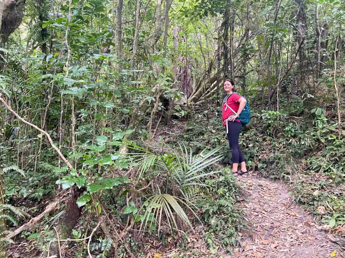
Two trails lead through native forest to the 521-metre summit. The Trig Track is steeper, narrower, and unformed, and you have to scramble over tree roots in parts.
The Wilkinson track is a wider, well-formed, gravel path that most visitors choose to take.
If you are reasonably fit, I highly recommend walking up the Trig and down the Wilkinson.
The Trig Track felt more immersed in the forest and we saw more birds. We didn’t find it too difficult and were fine in hiking sandals, but it would be slippy after rain.
Both tracks have bird feeders where you can watch rare birds like the little yellow hihi competing with the larger birds for sugar water.
We also saw korimako, weka, kaka, kereru, North Island robins, tui, kokako, fantails, saddlebacks, and whiteheads.
At the summit there are picnic tables for a lunch break and a lookout tower for sea views.
After the hike, you’ll likely have time left to relax on the pebble beach. I went for a swim and wished I’d brought snorkelling gear.
How to Get to Kapiti Island
Kapiti Island boat trips leave from Paraparaumu Beach, which is a 45-minute drive from Wellington. The boat ride takes 20 minutes to the island and the tour lasts five hours.
Book a Kapiti Island boat trip here. Make sure you book far in advance, as they do book up, especially in summer.
8) More Kapiti Coast Walks
If you have longer on the Kapiti Coast, there are many more fantastic walks.
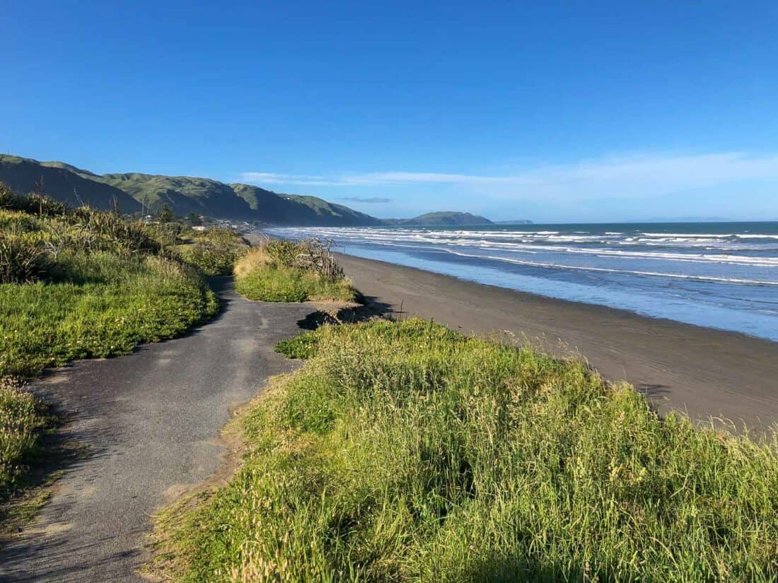
For an easy walk, any of the black sand beaches are wonderful for walking—they stretch for miles.
One of the most beautiful sections of the beach is in Queen Elizabeth Park between Paekākāriki and Raumati South.
You can walk along the beach (I like the Raumati end) or on one of the trails within the park.
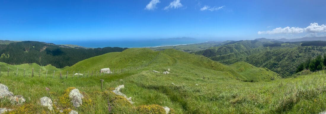
Another favourite spot that is often overlooked is Whareroa Farm, on the other side of the highway from Queen Elizabeth Park.
There are many trails for all abilities amongst rolling green hills. There’s a map and toilets at the car park.
We enjoyed the hike to the Rocks Viewpoint (5.5km/90 minutes return) on a grassy, overgrown trail up a hill.
Wellington Walks Map
Useful Resources
For more details on these walks, check out the Welly Walks app and Wellington Regional Trails website.
For bus and train routes, visit Metlink.
More North Island New Zealand Posts
- 22 Fun Things to Do in Wellington
- The Ultimate North Island New Zealand Itinerary
- 15 Best Things to Do in New Plymouth and Taranaki
- 15 Unforgettable Things to Do in Bay of Islands
- Visiting Magical Hobbiton in The Shire
Enjoyed this post? Pin for later!
Hi Erin,
Thanks for the great information about the walks around Wellington, have walked four of them as I lived in Wellington quite a few years ago. Hope to go back and do a few more when we return to visit relatives.
Jill
There are so many fantastic options in Wellington – glad you’ve enjoyed some already!